Karachi’s Urban State: City of Lights / City of Problems
Abstract
Karachi is the largest city of Pakistan, situated in the southwestern province of Sindh among mountains, plains, plateaus, rivers, and the Arabian Sea. With the largest seaport in the country, Karachi is the major trade route serving Pakistan, eastern China, India, and other central Asian countries. In 1947, at independence, Karachi was known as the City of Lights: a center of progressive thought, cultural diversity, and a metropolis providing refuge for migrating people of neighboring countries and regions. Political instability has since directly impacted the urban state of Karachi. The city once known for British-era architecture and modern lifestyles has, in the last fifty years, declined into ruined streets and extremist religious culture. This paper examines topography, housing types, infrastructure failure, governance, and whether a planned new city at Gwader can relieve Karachi’s urban crisis.
Keywords: Karachi, urban planning, kachi abadi, infrastructure, Gwadar, Pakistan
City of Lights / City of Problems
Karachi is the largest city of Pakistan, a country on the South Asian continent. It is situated in the southwestern province of Sindh amongst a cluster of mountains, plains, plateaus, rivers, and the Arabian Sea. With the largest seaport in the country, Karachi is the major trade route serving the entire country of Pakistan, eastern China, India, and other central Asian countries. In 1947 Pakistan gained independence from India. At that time, Karachi was known as the City of Lights. It was the center of progressive thought, cultural diversity, and a metropolis providing refuge for migrating people of neighboring countries and regions. But since that time, Pakistan has experienced political instability which has directly impacted the urban state of Karachi today. The city that was once known for its British-era architecture and its modern lifestyles has, in the last fifty years, declined into a city of ruined streets and extremist religious culture. This port city once known for its lights is now known for its smog. A city once known as a city of progress is now known as the city of problems.
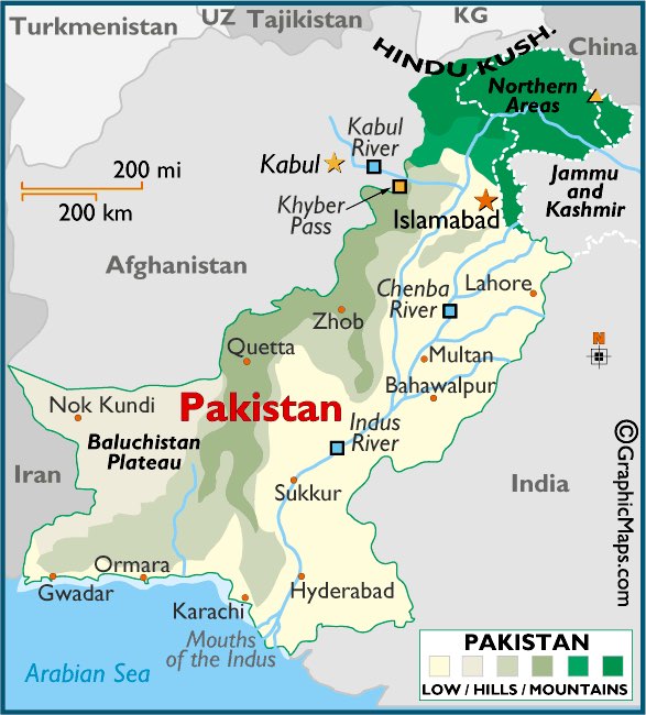
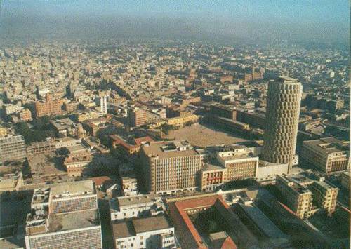
Karachi’s urban boundary is constrained by natural barriers of the sea to the south, the mountain to the northwest, and the Indus River to the east, leaving room for growth only to the north and resulting in a very dense urban fabric. The city lacks implementation of planned urban development, which has led to sporadic urban sprawl from a city center. The lack of planning has diminished a sense of community and citizenship. Instead, the urban community designs are geared toward individual and commercial needs. Furthermore, lack of city zoning and regulations has led to heavily dense areas which generate multiple problems such as traffic pollution, deterioration of roadways, early deterioration of structures, haphazard utility distribution, and a chaotic urban structure.
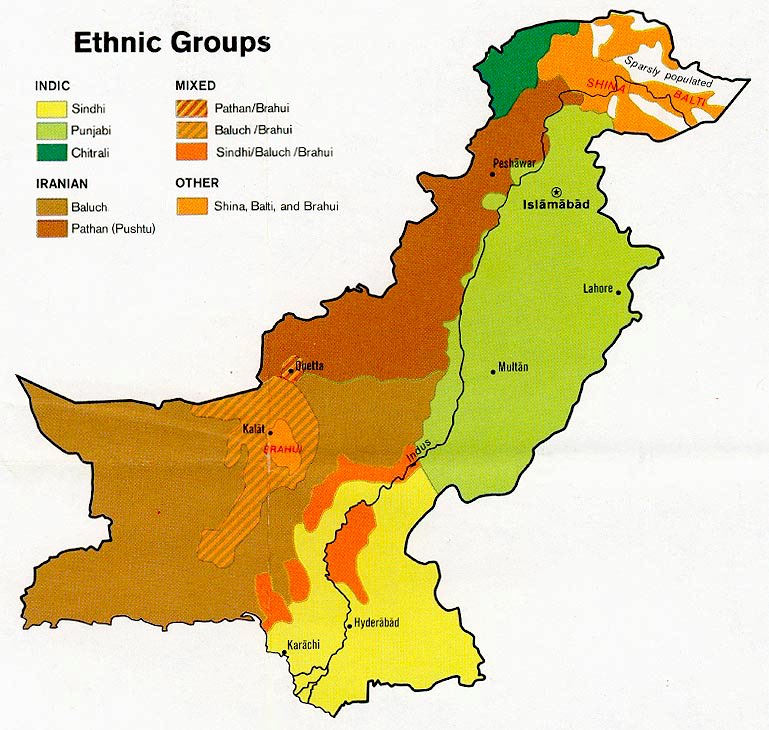
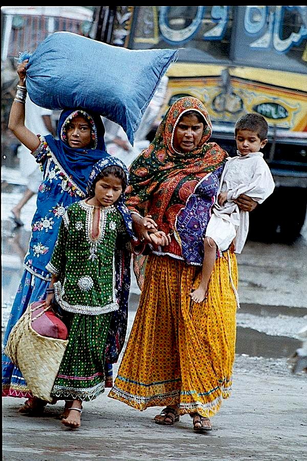
Karachi’s population is growing at a staggering rate. Currently housing 14 million, it is expected to double in population in the next decade. This population is comprised of Sindhis, Afghans, Baluchs from the plateau province of Baluchistan, Indians, Parsees from Iran, Punjabis from the eastern province of Punjab, and nomadic Iranian Pashtuns among others. This influx of population has shaped the housing types and has stressed the infrastructure of the city.
Housing Types
Karachi consists of three main housing types: single-family residences, multi-story flats, and kachi abadis or squatter settlements. The single-family residences are occupied by the upper to middle class. They are set back from the street with a full-height wall erected all around the house. A single, usually metal gate is the only means of entrance into the plot. This housing type allows the individual homeowners to turn their backs to the streets and the community. Thus the maintenance of public roadways is ignored. Most of the city streets are broken, with rubble gathered along the edges.
The multi-story flats are occupied by the middle to low-income class. They lack elevators and are typically secured communities with a gate or guard. Similar to the single-family residences, the flats also have a full-height wall separating interaction with the street. Utility distribution to the flats is very poor. Water is usually supplied for one hour each day and each resident must find means of storing the water for daily use. Furthermore, the utility lines are not sized to accommodate the community load. It is typical for the electricity to be shut off several times a week in these flats.
The constant influx of migration from outlying areas and poor planning by the government has resulted in a delayed response to the increasing housing demand, resulting in formation of kachi abadis or squatter settlements. These are either permanent or temporary shelters for the low-income groups or immigrants. They are located sporadically throughout the city and are often illegally occupied land. For example, a group of people will decide to settle on an empty lot of land and take occupation of it overnight without the permission of the government or property owner. These people are nomadic low-income groups usually from another overpopulated settlement or from a foreign region altogether. Large kachi abadi communities have formed around the perimeter of the city and along the rivers, thus becoming a permanent part of the urban fabric. Kachi abadis can range from tent-like structures or vernacular mud-brick construction typically housing an entire family in one room-size area, thus making them very dense settlements. These settlements are seen as a nuisance to the city locals due to their haphazard construction casting a poor image on the area. There is so much density in the city that government is shrugging its shoulders with lack of ability to provide a controlled response. Thus the government is slow to deal with the problems of this city.
Infrastructure
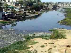
This influx and overgrowth in population has resulted in poor infrastructure. The utility lines throughout the city can no longer support the population’s demand. Furthermore, lack of organization by the unstable government has led to poor maintenance of the utilities. Kachi abadis particularly have no direct access to electrical or sewage systems and often improvise by illegally tapping into neighboring lines. There is no garbage pickup system or classified landfills in the city. Trash is generally dumped on the street side, in the river, or on empty lots. It is often burned, adding to the smog of the already polluted streets. There are no air-quality regulations to control the black clouds of smog that hover over every major city street. The sewage system is not maintained. The roadways are not maintained. In fact, no city systems are maintained.
The roads are not designed to handle their current capacity. A typical scene of the road includes motorcycles, bicycles, buses, trucks, cars, rickshaws, donkey carts, taxis, pedestrians and more traveling side by side. With minimum road widths, few lanes, and poor initial construction, the roads are quickly deteriorating with numerous potholes. Furthermore, there is no enforcement of traffic control. There are few intersections with traffic lights. Most of the traffic control is through congested roundabouts.
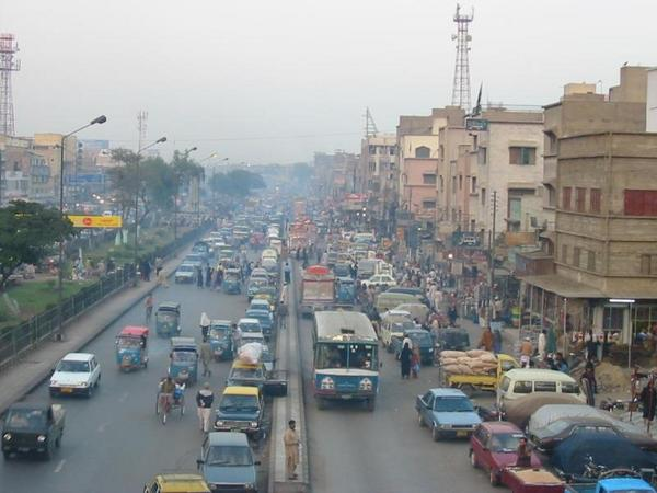
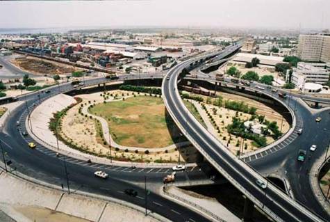
The circular railway that once served the perimeter areas of the city has now been abandoned due to government negligence to maintain it. A newly constructed superhighway connects major cities throughout the country but does little to serve Karachi’s inner network. The Pakistan railway similarly runs from city to city and does not have sufficient stops to serve as public transportation for Karachi alone. Most of the public transport is personal vehicles, taxis, or private buses contributing environmental pollution, noise, and chaos to the already stressed urban landscape.
Governance
Where is the government in all this? Karachi, the former capital of a country formed on religious beliefs, is now full of corrupt leadership that uses bribery to promote individuals in political and financial status. This corruption serves as a basis for appointments of individuals to political offices. In fact most of the government officials are either unqualified to hold their position or lack educational qualifications altogether. This form of government structure has led to neglect of the city’s urban structure. Thus the progress of most urban projects is directly related to these unorthodox business practices. Furthermore, feudal mafia lords terrorize the city officials and prevent urban progress. Most city walls are polluted with graffiti openly promoting the mafia gangs. At the same time, the changing government lacks cohesion, and is too scared to take charge to overtake the mafia stronghold over the city. This mode of thinking by the leadership over the past fifty years is now instilled in its people, leading to feelings of hopelessness and low community morale.
Assets
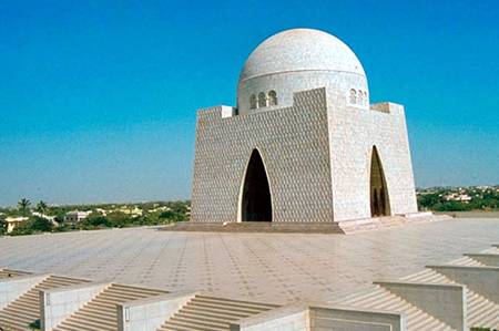
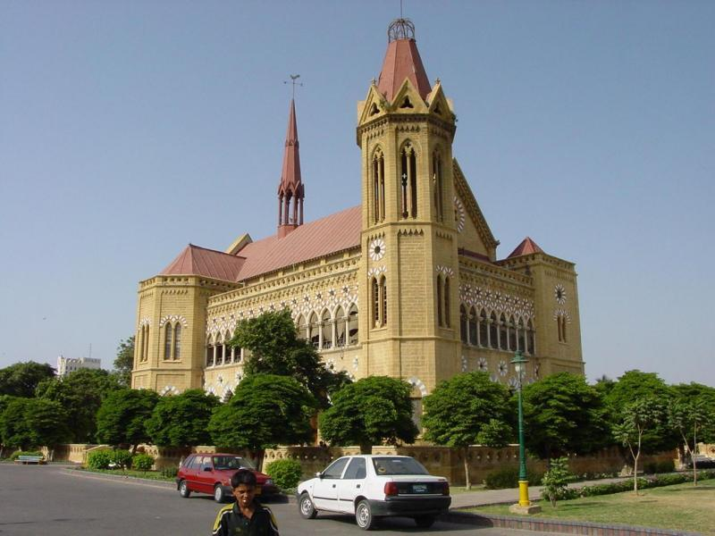
Karachi, even with all its problems, has many things in its favor. It has a strong history, a major seaport, and an educational system. Karachi was the former capital of the country and served as the residence for the founder of the nation of Pakistan, Quaid-e-Azam or Jinnah. Therefore, Karachi has historical significance in the country. The Jinnah Mausoleum is the resting place for the founder. It is raised on a high plateau and is the major monument visible throughout the city. Prior to partition from India, Karachi served as the center for British rule for then northern India. The cityscape is full of Anglo-style architecture which gives it a hierarchy in western thought in comparison to the remaining country.
Karachi’s port serves as the major trade route for Pakistan, providing 80% of the country’s revenue and commerce. This attracts a greater number of merchants to take up shop in the city, thus contributing to the job market. Furthermore, Karachi is the hub of education in Pakistan. Numerous educational institutions are scattered throughout the city. Some are reputable while others provide a minimal educational standard. In comparison to most of the country which lacks educational institutions altogether, education is an amenity that Karachi provides.
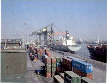
These positive aspects of the city can offer some hope for improvement of the urban environment. But thought processes need to shift in order for this change to occur. Education is the likely source for this improvement in thought. Currently, most of the educational institutions in Karachi are commercial enterprises rather than public services. Therefore, only a handful of the population can afford education. With most of the country uneducated, there is little hope for a revolutionary change in the urban structure or progress in thought.
Gwader and Urban Renewal
The future of Karachi seems bleak unless immediate implementation of an organized urban plan takes place, education systems are made available to a greater population, and appointments are made of honest government officials who will follow through with these plans.
As part of the current strategy to relieve the city’s urban problems, the government of Pakistan is making plans to create a new city. The city of Gwader is in the making northwest of Karachi close to the Afghan and Iran border. Gwader follows the western land-division structure focusing on upper- and middle-class housing. If Gwader is a success, it could be a new organized Karachi in the making. Some officials believe that in the upcoming years, much of Karachi’s population will relocate to Gwader in hopes of living in a better infrastructure with more employment opportunities. The feudal mafia is fighting against the creation of Gwader as they fear the loss of their stronghold on Karachi as the backbone of the country.
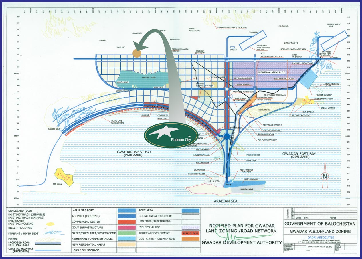
Gwader is a planned city with transportation routes, expansion plans, organized zoning, educational institutions, the first deep-sea port for Pakistan, and a modern utility infrastructure. This could be the future of Karachi and the answer to all its urban problems of overpopulation and density. With Karachi and Gwader in close geographical proximity, it is possible that these two cities could eventually merge as the population grows to infill the surrounding areas of the two cities. Even with the creation of this new city, special focus has to be placed on creation of low-income housing to replace and upgrade the current kachi abadis around Karachi. Gwader will further need to provide planned low-income housing to avoid a similar urban failure as Karachi.
Perhaps a relief from the current influx in Karachi will provide the breathing space the city needs to catch up to infrastructure and development demands. One thing is abundantly clear: Karachi is not going to be replaced anytime soon. It needs immediate measures for urban renewal to uphold its historic reputation as the City of Lights once again.
References
- Ardalan, N., & Bakhtiar, L. (1973). The sense of unity. University of Chicago Press.
- Cowasjee, A. (2004, September 12). Violation of the city. Dawn.
- Davidson, C. C. (1998). Legacies for the future: Contemporary architecture in Islamic societies. Thames and Hudson.
- Gurel, S., Ahmad, K. B., Ahmed, N., & Ahmed, S. (1994). Landscaping parameters. Architecture & Planning Publication Centre.
- Gurel, S., & Ahmad, K. B. (1991). Housing parameters. Architecture & Planning Publication Centre.
- Karachi Development Authority. (1991). Karachi development plan 2000. Master Plan & Environmental Control Department.
- Lari, Y. (2000). Karachi travel guide. Oxford University Press.